


ALPS mountain map

Descriere ALPS mountain map
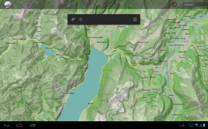
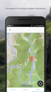
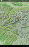
Topographic map of the Alps with Realtime GPS positioning.
- Summer Map: Topographic mountain range maps for all summer outdoor sporting activities such as hiking, rock climbing and mountain biking
- Winter Map: Topographic mountain range maps for winter outdoor sporting activities. Includes colored slope inclination and routes for ski tours and can also be used for snow-shoe tours.
The maps can be displayed either using an Internet connection or downloaded on your Android Smartphone or Tablet.
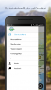
Other useful features include:
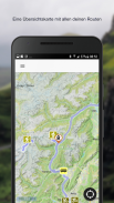
- Routes planned on http://alpenkarte.eu can be downloaded onto your Android Smartphone or Tablet by simply scanning the generated bar code and used offline
- Realtime GPS positioning
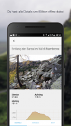
- Distance and altitude covered can be subsequently sent per Email

ALPS mountain map - Informații APK
Versiune APK: 9.7.0Pachet: net.mountainmap.naviCea mai recentă versiune a ALPS mountain map
Alte versiuni


Aplicații din aceeași categorie

S-ar putea să îți placă și...


